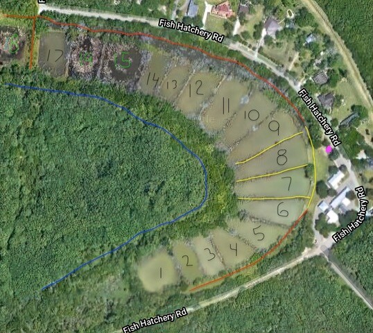
The team of volunteers are planning to get together tomorrow (4/24) for our first planning and work day at the TPWD Lower Laguna Madre Coastal Fisheries Field Office, aka our Fish Hatchery site. The site map was created from an image from Google Earth with numbers assigned to each of the eighteen ponds.
Highlighted are two trails for our team to consider as a place for us to begin. The yellow trails will need to be assessed to see if a trail could be cleared to extend completely between two ponds or, if the erosion is too bad, the soil too soft, or the path too narrow, we limit its length.
The red trails would create a trail along the outer perimeter. We’ll need to scout the potential paths, maybe tag invasive plants for removal or tag natives to clear or trim to provide a safe path.
The pink spot is for a brush pile that we can add to with our debris. Outlined in blue is the southern property boundary.